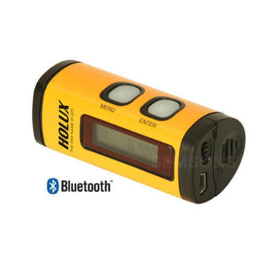
Holux M-241 Bluetooth GPS Data logger
Holux M-241 Bluetooth GPS Data logger
Couldn't load pickup availability
This item has been discontinued by the manufacturer.
Recommended replacement products are :
==========================================
Holux M-241 Bluetooth GPS Data logger with ezTour Software (LCD display, 130,000 waypoints, WAAS, Run on AA battery)
The M-241 is a high performance wireless GPS logger with the following features:
-
Dual interface (Bluetooth + GPS-mouse by USB cable).
-
Compatible with Bluetooth Serial Port Profile (SPP) completely.
-
Powered by one AA battery.
-
LCD display to show position information, speed, capable logging memory size, date & time.
-
Capable memory size to record up to 130,000 positions, including longitude, latitude, time,
and altitude.
- Personal settings to select the logging mode by distance or time, unit by Kilometer or mile.
M-241 on the Plane.
|
Specifications: |
|
|
|
‧ |
32 parallel satellite searching channels |
|
|
‧ |
Receiver: L1, 1575.42 MHz |
|
|
‧ |
Frequency: 1.023 MHz |
|
|
‧ |
Update frequency: 1 Hz. |
|
|
‧ |
Antenna type: Built-in |
|
|
‧ |
Satellite signal reception sensitivity: -159dBm |
|
|
‧ |
Dimensions: 32.1mm X 30mm X 74.5mm |
|
|
‧ |
Weight (excluding battery): < 39g. |
|
|
‧ |
Switch: Slider switch |
|
|
‧ |
1 AA alkaline battery lasts for up to 12 hours of operation |
|
|
‧ |
Operating temperature: 0 ℃ to + 50 ℃ |
|
|
‧ |
Storage temperature: -10 ℃ to + 60 ℃ |
|
|
‧ |
Operating humidity: 5% to 90% |
|
|
|
Positioning |
|
|
‧ |
Non DGPS (Differential GPS): |
|
|
‧ |
Position : 3.0 M CEP excluding SA |
|
|
‧ |
Velocity: 0.1M / sec. |
|
|
‧ |
Interval: 0.1 sec to Sync GPS |
|
|
‧ |
DGPS (EGNOS/WAAS/MSAS): |
|
|
‧ |
Position: |
< 2.2 M., Horizontal deviation 95% time |
|
|
< 5 M., Vertical deviation 95 % time |
|
|
|
*The above data is based on the specifications of the MTK GPS chip |
|
|
|
Positioning Timing |
|
|
‧ |
Time to reposition < 0.1 sec average |
|
|
‧ |
Hot boot 1 sec |
|
|
‧ |
Warm boot 33 sec |
|
|
‧ |
Cold boot 36 sec |
|
|
|
*The above data are based on specifications of the MTK GPS chip |
|
|
|
Physical Specifications |
|
|
‧ |
Sea level: Max 18,000 M (60,000 feet) |
|
|
‧ |
Velocity: Max 515 M./sec ( 1000 knots) |
|
|
‧ |
Acceleration: Max 4G |
|
|
‧ |
Vibration: 20 M/ second3, Max. |
|
|
|
Buttons |
|
|
‧ |
1 Power switch, 2 Buttons (Menu and Confirm) |
|
|
|
LCD display page |
|
|
‧ |
System and satellite positioning status |
|
|
‧ |
Time |
|
|
‧ |
Position |
|
|
‧ |
Velocity |
|
|
‧ |
Distance measurement |
|
|
‧ |
Setup |
|
|
|
|
|

The ezTour software with its powerful and easy to use interface allows the user to upload a track
file saved from the M-241 and then use the track information to geotag flicker photos that are taken
in the same time period as the track file. Outputting html information to build the photo albums
based on Google maps or on a static map image is only in one painless click. Geotagging ones’
blog posts and sharing ones’ outdoor activities with others is never easier.
-
Directly playback track log on Google map.
-
Allow comments on photos and change name for track logs.
-
Edit, Split , Merge Track Logs
-
Photo slide show while play back track logs.
-
Show Altitude in Graph
-
Support Multi-language


