SurPad 4.2 Field Data Collection Software (Android Compatible)
SurPad 4.2 Field Data Collection Software (Android Compatible)
Country of Origin: China
Couldn't load pickup availability
Volume Discount Table
| Minimum Qty | Discount |
|---|---|
| 2 + | 5% off |
| 5 + | 7% off |
| 10 + | 10% off |
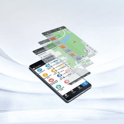
SurPad 4.2 is a professional app designed for precise positioning and data collection, running on Android OS. It supports a range of surveying and mapping tools, including GPS/GNSS RTK receivers and total stations. Popular in Land Surveying, Civil Engineering, and Construction Staking, it offers unmatched ease in data gathering and excellent performance in field data calculations.
Features:
- Full RTK GNSS support.
- Multiple languages.
- Powerful CAD function.
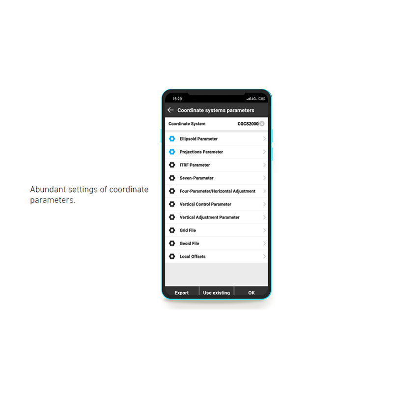
- Multiple coordinate systems.
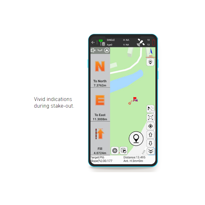
- Road design and stakeout.
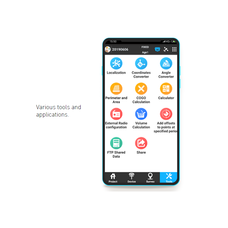
- Powerful COGO tool.
- FTP shared data.
- Dynamic toolbar.
Main Functionalities:
Measure Points in the Field
Run on any Android Device
Not limited to Android controllers, Surpad can run on almost all Android devices, including Android tablets and phones. With a larger screen and higher configuration, users will have a better operating experience: displaying more measurement information, richer point-line-surface graphics, and faster loading and processing speeds for files.
New Code Library
We have rebuilt a new code library. In this new code library, users can group codes, enable automatic connection of points with the same code to form lines, polylines, or polygons. Additionally, users can define elements of the corresponding codes to be used on the target layer. Different elements of points and lines with different codes can be set unique symbols and colors.
GIS Data Collection
In GIS data collection, users can collect and save points, lines and polygons with more attributes, including quantity, length, height, area, description, photos and etc. It means that more attributes and information will be further used and it will help us to analyze, make decisions and forecast.
Customized Toolbars
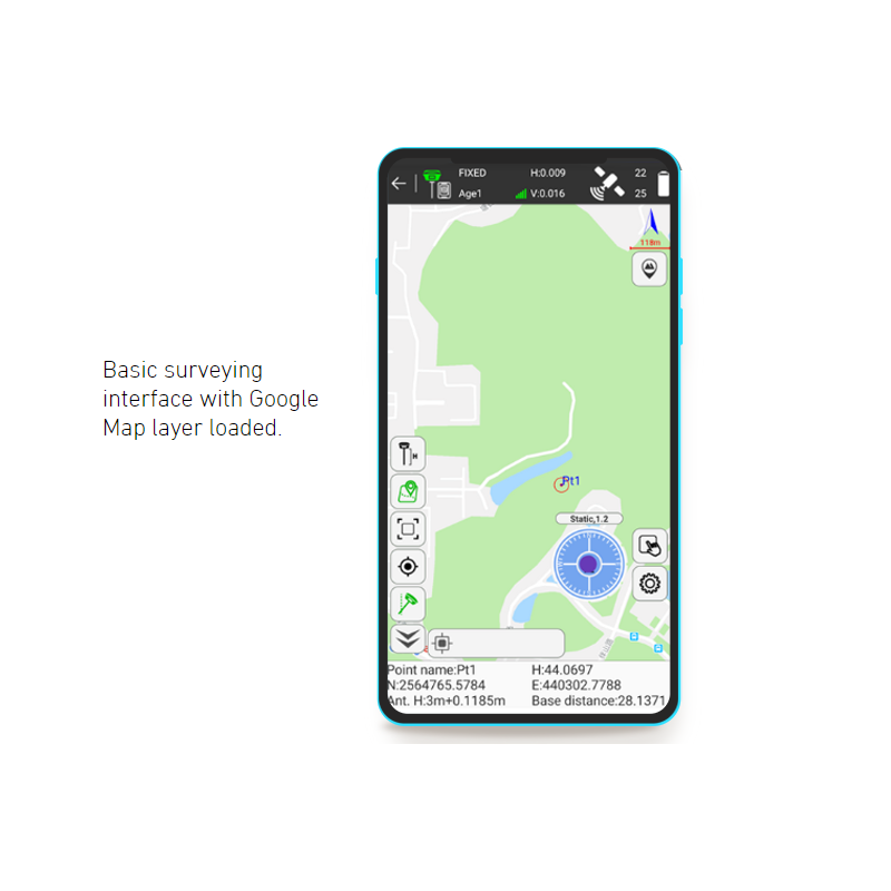
In both survey and stakeout functions interface, we have designed a rich and customizable information bar and toolbar. Users can customize the information and tools they need based on their personal preferences and measurement requirements. The most commonly used tools include tilt survey, jump to map center, and display map.
WMS and WFS Support
Surpad supports online Google Maps and OpenStreet Map. With the development of GIS, WebGIS data sources have become increasingly abundant, and more and more internet maps are available. Users can access a wider range of WebGIS network maps in Surpad.
Map Calibration
This feature allows users to calibrate and adjust maps to ensure that the positions on the map align with the actual locations of measurement data. Users can perform calibration operations based on known control points or georeferencing systems, improving the accuracy and reliability of the map.
DSM Stakeout
DSM stands for Digital Surface Model. We can use the designed DSM to perform layout work within the covered measurement area. When using DSM for layout on Surpad, extensive calculations are performed to determine the corresponding cut and fill heights between the target survey area and the designed DSM.
SHP Format Export
Surpad support for the SHP format (Shapefile), which is a commonly used GIS data format. Users can utilize the software for GIS data collection of forestry and attribute information, saving and exporting the data in SHP format.
COGO Calculation
Built-in COGO calculation—cropping area, positive calculation, inverse calculation resection, forward intersection, vertical distance calculation, extend point calculation, equal point calculation and etc. When you use COGO calculation tools, the calculation process and result are recorded at the same time.
Ionosphere TEC
TEC stands for Total Electron Content. Ionospheric activity can affect the operation and accuracy of GNSS receivers. During periods of significant ionospheric influence, TEC values are higher, making it difficult for GNSS to keep fixed solution, leading to bad accuracy and stability. The year 2024 is expected to experience severe ionospheric impact.
Perfectly Compatible with G40 AR GNSS Receiver
Product Resources
Official Documents:
Tech Support Topics and Forums:
